
From raw data to confident direction—faster, clearer, smarter. See how GeoservAi turns diverse, uncertain subsurface data into drill-ready targets.

Every project follows the same disciplined path, from acquisition to ranked, drill-ready targets.

Capture multiple physical signals.

Align, clean and contextualise data.

Convert signals into subsurface responses.

Build an integrated geological model.

Prioritise with clarity. Drill with confidence.
Four complementary sensing technologies. One integrated understanding.
Measures reflected and emitted energy across multiple wavelengths.
RevealsBest for: Regional screening, alteration mapping, lithology discrimination.
Detects minute ground movements using phase differences.
RevealsBest for: Geohazard assessment, reservoir integrity, infrastructure risk.
Captures natural Earth vibrations across frequency bands.
RevealsBest for: Fracture characterisation, resource targeting, seismic hazard insight.
Maps variations in subsurface physical properties.
RevealsBest for: Basin-scale modelling, structural interpretation, complex geology.
Integrated insight. Reduced uncertainty. Better outcomes.
By integrating these sensing technologies, GeoservAi delivers a multi-dimensional view of the subsurface—revealing what traditional methods miss and turning complexity into clarity.
The GeoservAi Subsurface Intelligence Engine converts complex data into actionable geological intelligence.
Built for the subsurface.
Always preserved.
Every output tested.
From drill targeting to resource models.
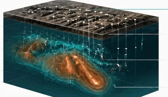
The interpretation engine runs inside a sealed, air-gapped environment: a target is validated only when all five layers of analysis converge on the same 3D coordinates, and the engine resolves 12 layers of subsurface intelligence from the surface down to 4,500 metres. Clients receive verified target coordinates and drill schedules while the algorithms and calibration weights stay protected.
It keeps learning too. As drilling progresses, assay results, depth intersections and core observations feed back into the engine, which recalibrates the model within hours and sharpens the coordinates, angles and depths of the next holes.
From complex datasets to clear exploration decisions. From uncertainty to opportunity. From data to discovery.
Clear, ranked targets with confidence and value indicators.
Right holes, right places, right sequence.
Understand geological risk and potential reward before you drill.
Clear actions. Confident decisions. Greater impact.
Integrate data. Interpret structure. Build a robust 3D geological framework.
Quantify prospectivity. Rank targets by potential and confidence.
Design drill programmes to test the right targets at the right depth.
Simulate outcomes. Optimise strategy. Maximise value.
Tell us about your project and we’ll walk you through what GeoservAi can reveal.